The Community
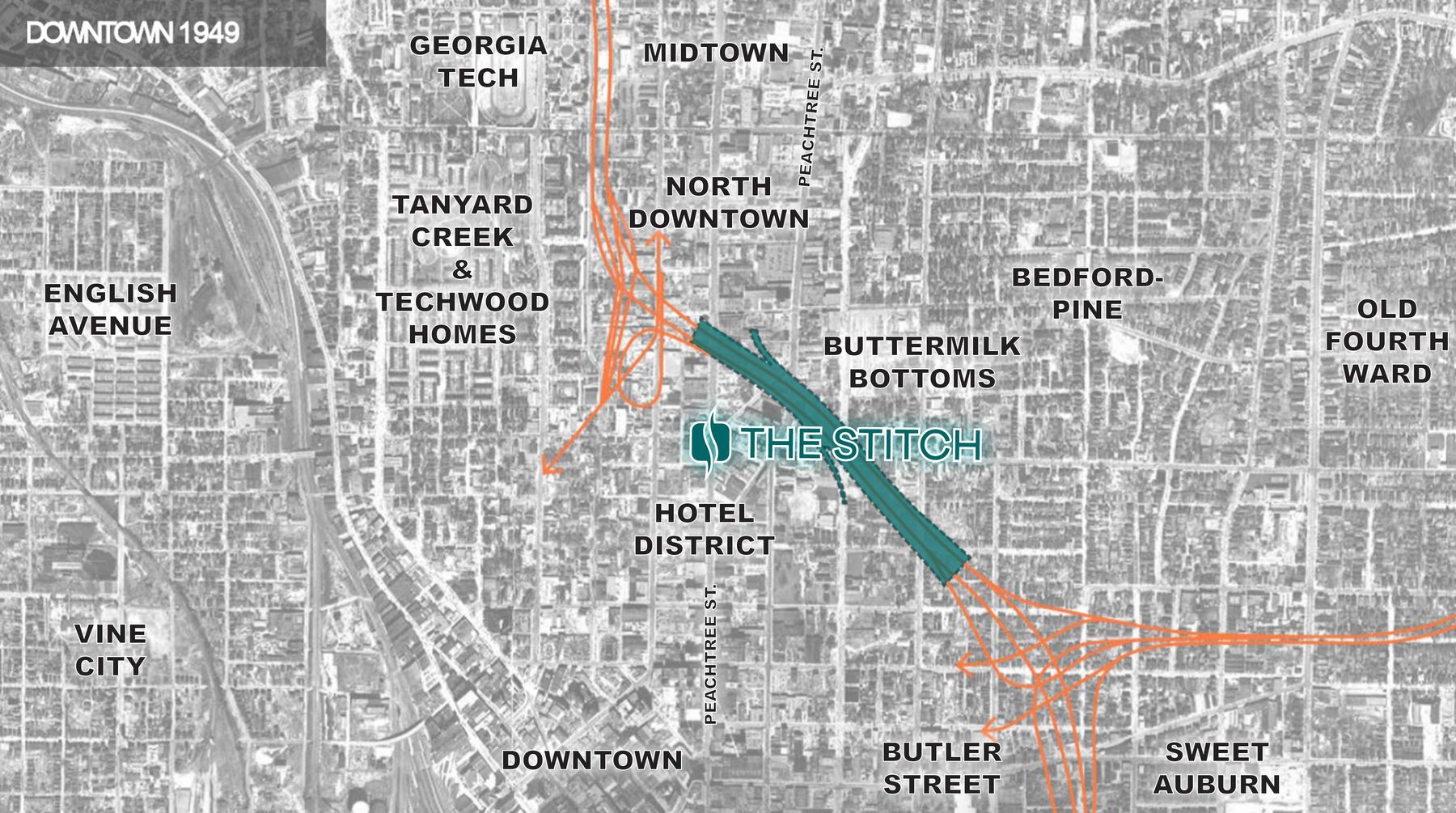
The Stitch will reconnect Downtown Atlanta and catalyze the creation of a new inclusive and vibrant community.
The Stitch will unite Downtown Atlanta and beyond via an interconnected network of parks, transportation options, and neighborhoods. The result will be a connected hub for a diverse and inclusive Downtown community to live, work, and thrive together.
Top Image Source: Russell Stough Miller, ARTSATL
History
The construction of the Downtown Connector and other "urban renewal" projects in Atlanta throughout the 20th century disrupted and disconnected predominantly low-income Black communities. While adjacent neighborhoods have seen rapid growth and success, these areas remain stymied to this day due to the lasting scars of these projects.

1917
Atlanta’s Great Fire
Following Atlanta’s Great Fire, the Bedford Pine neighborhood began to rebuild as a predominately Black community within the City of Atlanta’s Fourth Ward.
Image source: The Atlanta Journal Constitution
1920s - 1950s
The Great Depression and Post-War Eras
The less-desirable land between Peachtree Street and Boulevard attracted dense, poorly constructed structures. The area became known as Buttermilk Bottom. (pictured left)
Meanwhile, the commercial growth of Downtown marched north along Peachtree Street. (pictured right)
Image Sources: Georgia State University Library
1930s
Beginning of Urban Renewal in Atlanta
The Tanyard Creek community (pictured right), an integrated working-class neighborhood south of Georgia Tech campus, is demolished, displacing over 1,600 families. It is redeveloped into the Nation's first public housing project, Techwood Homes. Techwood Homes was a segregated community for white working-class families until integration in the 1960's.
Image Source: Digital Library of Georgia
1946
Lochner Expressway Plan released that includes a 6-lane “Downtown Connector”
City officials requested that the expressway be built through the areas of the city where “it would be feasible to purchase suitable rights-of-way, being the most depreciated and least attractive, [and] in need of rejuvenation.” The neighborhoods through which the expressways were planned were described as “depreciated” and so in need of improvements that the construction of the road system could be “classed as slum clearance.” The Connector was to act as a barrier “between the central business district and the East Side African American Community.”
Image Source: 1946 Highway and Transportation Plan for Atlanta, Georgia, Georgia Tech Library
1948 - 1964
Construction of the Downtown Connector
Land Clearing for the Downtown Connector begins in 1948 eventually displacing over 7,000 Black Atlantans and contributing to the elimination of the Buttermilk Bottoms and Butler Street neighborhoods. Federal-aid funding in 1954 provided the necessary capital to complete the project. The Downtown Connector opened to the public on September 18, 1964.
Image Source: Russell Stough Miller, ARTSATL
1969
Merger of Buttermilk Bottoms and Bedford-Pines Redevelopment Areas
Following the completion of the Atlanta Civic Center urban renewal project, two Urban Redevelopment Area (URA) plans are combined into one large 278-acre Bedford Pines Urban Redevelopment Area that now includes the former Buttermilk Bottom plan area. This leads to additional urban renewal projects further disrupting these communities.
Image Source: Georgia State University Library
1976-1988
Widening of the Downtown Connector
When the Federal-Aid Highway Act of 1976 expanded the use of funds to include reconstructions, the stage was set for the Downtown Connector to be widened from six lanes to ten. The Downtown Connector widening begins in 1984, further impacting adjacent land parcels and buildings. The Downtown Connector as we know it today was completed in 1988.
Image Source: Georgia State University Library
Neighbors Reunited
While there is no bringing back communities destroyed by the Downtown Connector, the Stitch will reconnect neighborhoods that have remained separated for over half a century.